North Carolina
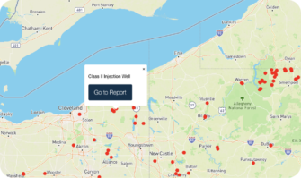
The National Energy and Petrochemical Map shows data on statewide energy infrastructure.

The National Energy and Petrochemical Map shows data on statewide energy infrastructure.
The N.C. Geological Survey, housed in the Department of Environmental Quality, has concluded that a viable reserve of natural gas may underlie parts of the state’s Triassic basins. Technically recoverable gas is thought to exist in the Sanford sub-basin (including Lee, Chatham and Moore counties) and possibly the Dan River sub-basin (including Stokes and Rockingham counties). Learn more
Recently, drilling has been proposed off of the coast of NC, however, but the extent to which that happens remains to be seen. Learn more
Presently there is no large scale oil and gas extraction occurring on land in North Carolina, but this industrial activity may begin in the near future. Due to a fairly recent law, horizontal drilling and injection wells (e.g. fracking) are now legal. The law also mandated that the Mining and Energy Commission develop a regulatory framework for the modern drilling techniques. The Commission has since created new rules, which can be found here:
Oil and Gas Conservation Rules – Final 2015
When we compiled our national map of oil and gas wells in 2014 and in 2015, we were told that there were two active oil and gas wells in the state of North Carolina, but that data about those wells were currently unavailable. We have followed up on this matter multiple times, but received no further replies.
If you are approached to lease your mineral rights for oil and gas drilling, this website offers valuable tips for things to consider.
As data become available regarding oil and gas drilling in NC, including the use of well stimulation techniques such as fracking, we will update this page. In the meantime, below are resources that you can use to learn more about the potential for drilling in NC, as well as concerns and current research.
FracTracker provides state-specific data on issues such as:
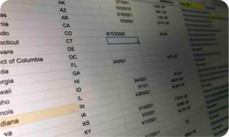
The data folders may also contain information on other energy generation locations, data from different years, and data on violations committed by oil and gas facilities. Amount of information and types of information will vary by state. Get data.
Shale Gas Extraction in North Carolina: Research Recommendations and Public Health Implications – A summary by Adrian Down, Martin Armes, and Robert Jackson of a summit held in October 2012 by the Research Triangle Environmental Health Collaborative.
 https://fractracker.org/wp-content/uploads/2021/06/SShamer_Infrastructure-pipeline-rightofway-ColumbiaLineMB-BaltimoreCounty-MD-May2016.jpg
266
400
FracTracker Alliance
https://fractracker.org/wp-content/uploads/2025/09/2025-Wordmark-Logo.png
FracTracker Alliance2025-09-03 16:14:462025-09-30 10:26:57Comment Opposing the Southeast Supply Enhancement Project (SSEP) – Clean Water Act Section 404 Permit Application (SAW-2024-01961)
https://fractracker.org/wp-content/uploads/2021/06/SShamer_Infrastructure-pipeline-rightofway-ColumbiaLineMB-BaltimoreCounty-MD-May2016.jpg
266
400
FracTracker Alliance
https://fractracker.org/wp-content/uploads/2025/09/2025-Wordmark-Logo.png
FracTracker Alliance2025-09-03 16:14:462025-09-30 10:26:57Comment Opposing the Southeast Supply Enhancement Project (SSEP) – Clean Water Act Section 404 Permit Application (SAW-2024-01961) EPA
https://fractracker.org/wp-content/uploads/2021/05/Colonial-pipeline-spill-feature.jpg
667
1500
Karen Edelstein
https://fractracker.org/wp-content/uploads/2025/09/2025-Wordmark-Logo.png
Karen Edelstein2021-05-26 07:00:272023-07-18 10:31:34Impacts of 2020 Colonial Pipeline Rupture Continue to Grow
EPA
https://fractracker.org/wp-content/uploads/2021/05/Colonial-pipeline-spill-feature.jpg
667
1500
Karen Edelstein
https://fractracker.org/wp-content/uploads/2025/09/2025-Wordmark-Logo.png
Karen Edelstein2021-05-26 07:00:272023-07-18 10:31:34Impacts of 2020 Colonial Pipeline Rupture Continue to Grow https://fractracker.org/wp-content/uploads/2020/02/National-map-feature-3.png
400
900
Erica Jackson
https://fractracker.org/wp-content/uploads/2025/09/2025-Wordmark-Logo.png
Erica Jackson2020-02-28 17:35:142022-05-02 15:21:42National Energy and Petrochemical Map
https://fractracker.org/wp-content/uploads/2020/02/National-map-feature-3.png
400
900
Erica Jackson
https://fractracker.org/wp-content/uploads/2025/09/2025-Wordmark-Logo.png
Erica Jackson2020-02-28 17:35:142022-05-02 15:21:42National Energy and Petrochemical Map
216 Franklin St, Suite 400, Johnstown, PA 15901
Phone: +1 (717) 303-0403 | info@fractracker.org
FracTracker Alliance is a 501(c)3 non-profit: Tax identification number: 80-0844297